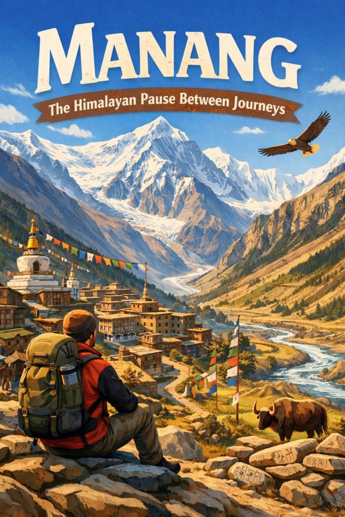
The road to Manang does not rush you. It arrives slowly, thinning the air, quieting the mind, teaching the body to listen before it asks for more. By the time you reach this high Himalayan village, the idea of destination has already begun to soften. Steps slow. Breaths deepen. Journeys pause—not because there is nowhere to go. But because here, at altitude and silence, movement finally learns the value of stillness.
Manang is not merely a stop on a trekking map. It is a space between before and after. A place where the Himalayas insist that you wait, acclimatize, and pay attention—not just to oxygen levels, but to yourself. Surrounded by stone houses, glacial lakes, and prayer flags, Manang impresses with peaks that seem impossibly close. It becomes less about where you are heading next. It’s more about where you are standing now.
This is the Himalayan pause between journeys.
Table of Contents
- Understanding Manang in the Himalayas
- Manang and the Annapurna Circuit
- Routes and Access to Manang
- Life in Manang Village
- Food, Water, and Survival at Altitude
- Stay, Facilities, and Infrastructure
- Health, Acclimatization, and Safety
- Places to Visit Around Manang
- Manang Across Seasons
- Weather, Light, and Atmosphere
- Culture, History, and Trade Legacy
- Environment, Ecology, and Climate Change
- Manang Beyond Trekking
- Economy, Tourism, and Change
- Practical Travel Planning
- Digital Nomads and Long Stays
- Frequently Asked Search Queries About Manang
- References And Further Reading
- Final Reflection
Understanding Manang in the Himalayas
Manang village Nepal overview
Manang is a high-altitude Himalayan village that feels less like a destination and more like a threshold. Manang is situated on the northern side of the Annapurna range. It is best known as the natural resting point on the Annapurna Circuit. Reducing it to a trekking stop misses its deeper character. Stone houses cling to dry slopes, prayer flags mark wind paths, and daily life unfolds slowly under immense skies. Manang lies at the junction of endurance and adaptation. It is also a place for quiet reflection. It is shaped as much by altitude as it is by centuries of mountain wisdom.
Where is Manang located in Nepal
Manang lies in north-central Nepal, within Manang District of Gandaki Province, above the Marsyangdi River valley. It sits beyond the rain shadow of the Annapurna massif. This location gives the region a drier, more Tibetan plateau–like feel compared to the greener lower Himalayas. Geographically, Manang connects the lush middle hills of Nepal to the stark trans-Himalayan landscapes. These landscapes stretch toward Mustang and Tibet.
Manang altitude and elevation explained
Manang village stands at approximately 3,540 meters (11,614 feet) above sea level. At this height, oxygen levels are significantly lower, and the body is forced to slow down and adapt. This altitude is high enough to trigger acute mountain sickness if rushed, yet stable enough to allow safe acclimatization. That balance is precisely why Manang has become essential on the Annapurna Circuit. It is where speed gives way to patience, and listening to the body becomes more important than covering distance.
Geography of Manang Valley
The Manang Valley is broad, open, and dramatic. It is framed by towering peaks such as Annapurna III, Gangapurna, and Tilicho Peak. Unlike narrow Himalayan gorges, the valley opens outward, creating a sense of vastness and exposure. Glacial lakes, high alpine pastures, and moraines shape the terrain, while cold winds sweep through in the afternoons. The valley’s geography encourages stillness. There are few places to hide from scale here. The land constantly reminds visitors of their smallness.
Landscape transition from Marsyangdi Valley
The approach to Manang follows the course of the Marsyangdi River, and the transformation is gradual but unmistakable. Lower sections of the Marsyangdi Valley are green, humid, and densely vegetated. As altitude increases, forests thin, moisture disappears, and colors shift from green to ochre and grey. By the time Manang appears, the landscape feels almost lunar—dry, wind-sculpted, and starkly beautiful. This transition is not just visual; it mirrors the internal shift travelers experience as the mountains demand slower rhythms.
Why Manang is called the Himalayan pause
Manang is often described as a pause because it interrupts momentum. Trekkers are advised, sometimes forced, to stop here for acclimatization. But beyond medical necessity, the pause is psychological. Time stretches. Days are spent walking slowly, drinking tea, watching clouds, and waiting for the body to adapt. In a journey defined by forward motion, Manang introduces intentional stillness. It teaches that rest is not weakness, but preparation.
Meaning of Manang in local context
For the Manangi people, Manang is not a pause—it is home. Traditionally traders and trans-Himalayan navigators, Manangis have long lived between worlds. They lived between Nepal and Tibet, winter and summer settlements, and trade and isolation. The village represents continuity rather than interruption. Its rhythms are seasonal, its patience inherited. What visitors see as a moment of waiting is different for locals. For them, it is a way of life shaped by altitude, climate, and resilience.
In this sense, Manang becomes a shared space. Travelers temporarily step into a slower, older understanding of time. This understanding is defined not by schedules, but by mountains, weather, and breath.
Manang and the Annapurna Circuit
Manang on the Annapurna Circuit map
On the route of the Annapurna Circuit, Manang is not a midpoint by distance. It is a turning point by experience. It is located roughly halfway through the circuit. Manang is the last large, well-established settlement. Beyond this point, the terrain becomes harsher and more exposed. On trekking maps, Manang sits just north of the Marsyangdi Valley’s deepest sections. Here, the trail opens into wide alpine basins. The Himalayas feel suddenly closer. Cartographically, it marks the transition from lower Himalayan trekking to high-altitude crossing.
Why Manang is a mandatory acclimatization stop
Manang is considered mandatory because the body cannot safely jump from the lower villages to the high passes without adjustment. At 3,540 meters, Manang provides the ideal altitude for acclimatization. It is high enough to stimulate red blood cell production. Yet, it is stable enough to allow rest. Skipping Manang dramatically increases the risk of acute mountain sickness before Thorong La. Over decades, trekkers, guides, and medical professionals have collectively learned this important lesson. Manang is not optional. It is the mountain’s built-in safeguard.
Manang acclimatization day itinerary
A typical acclimatization day in Manang is deliberately slow. Mornings often start with a short, gradual hike to a higher elevation. This is commonly toward Ice Lake or nearby ridges. Afterwards, you return to sleep at the village altitude. Afternoons are spent resting, hydrating, eating warm food, and avoiding exertion. Many trekkers attend the daily altitude briefing at the Himalayan Rescue Association clinic, reinforcing awareness and respect for the environment. The rhythm of the day reinforces a core Himalayan rule: climb high, sleep low, and listen closely to your body.
How long to stay in Manang village
Most trekkers stay two nights and one full rest day in Manang, though some remain longer if symptoms persist. Strong, well-acclimatized hikers may feel physically capable of moving on sooner, but experience shows that patience here pays dividends later. Additional nights are not wasted time; they increase safety margins and mental readiness. In Manang, staying longer is often a sign of wisdom rather than weakness.
Manang before Thorong La Pas
Manang is the final place where comfort and choice still exist before the ascent toward Thorong La Pass. Beyond Manang, settlements become smaller, nights colder, and the margin for error thinner. Thorong La, rising to 5,416 meters, demands respect, preparation, and restraint. Manang offers the last opportunity to assess health, weather, and confidence. It is where trekkers decide whether they are ready to continue upward or need to pause further.
Manang to Yak Kharka distance and terrain
The trail from Manang to Yak Kharka covers roughly 10 kilometers, but distance matters less than terrain and altitude gain. The path climbs gradually through open alpine landscapes, crossing grazing pastures and wind-swept slopes. Oxygen thins noticeably, and even gentle inclines feel demanding. The terrain is less forested. It is more exposed. This reinforces the sense that Manang was the final sheltered space before true high-altitude trekking begins.
Mental preparation after Manang
Leaving Manang is as much a psychological shift as a physical one. After days of rest and reflection, movement resumes—but at a slower, more deliberate pace. Trekkers learn to abandon expectations of speed and embrace discipline, routine, and humility. Manang teaches that strength in the Himalayas comes from restraint, not force. By the time one walks away from the village, the mindset has changed. The journey ahead is no longer about progress. It becomes about presence, awareness, and respect for altitude.
In this way, Manang becomes the emotional and mental fulcrum of the Annapurna Circuit. It is the place where ambition is tempered. The mountains are truly acknowledged here.
Routes and Access to Manang
How to reach Manang from Kathmandu
Reaching Manang from Kathmandu is a journey that gradually strips away urban rhythm and replaces it with mountain logic. The route moves northwest from the capital into the central Himalayas, following the Marsyangdi River corridor. Travelers have three options to reach Manang. They can go by road, by a combination of road and trekking, or entirely on foot via the Annapurna Circuit. Each approach offers a different relationship with distance, time, and altitude, and the choice shapes how Manang is experienced.
Kathmandu to Manang by road
The road journey starts with a long drive from Kathmandu to Besisahar. After that, it continues through rough mountain tracks toward Chame and Manang. This route has improved in recent years but remains slow, unpredictable, and highly dependent on weather and landslides. Road access has made Manang reachable within two days by jeep. However, the rapid altitude gain leaves little time for natural acclimatization. Travelers who choose this option often need additional rest days upon arrival to allow the body to adjust.
Besisahar to Manang jeep route
Besisahar marks the traditional gateway to the Annapurna region and the starting point of motorable access toward Manang. Shared or private jeeps travel from Besisahar along the Marsyangdi Valley, crossing suspension bridges, cliff-hugging tracks, and riverbeds. The journey is rugged and visually striking but physically demanding due to constant jolting and dust. While efficient, the jeep route compresses what was once a week-long ascent into a single long day. This change affects both the physical and emotional pacing of the journey.
Trekking routes to Manang village
The classic trekking approach follows the Annapurna Circuit, starting from villages such as Besisahar or Chame. This route passes through subtropical forests, waterfalls, and gradually ascending valleys before reaching the dry, high-altitude terrain of Manang. Walking allows the body to adapt naturally and offers deeper immersion into village life, landscape transitions, and cultural rhythms. For many, arriving in Manang on foot makes the village feel earned rather than accessed.
Alternative trails and old Manang routes
Before roads reached the valley, Manang was accessed through ancient footpaths used by traders and herders. Some of these old routes still exist as higher, quieter trails that bypass road sections. These alternatives offer solitude, stronger altitude progression, and a sense of historical continuity. Walking these paths reveals how Manang functioned long before tourism—connected by effort, not engines.
Road vs trekking experience comparison
Traveling by road prioritizes speed and convenience, but often at the cost of gradual acclimatization and emotional buildup. Trekking, while slower and physically demanding, allows the body and mind to synchronize with altitude and landscape. Those who walk into Manang tend to experience the village as a natural pause. In contrast, those who arrive by jeep often experience it as a sudden stop. Neither approach is wrong, but they produce fundamentally different relationships with the place.
Routes and Access to Manang Explained
| Route / Method | Starting Point | Travel Mode | Time Required | Altitude Gain Pattern | Best For | Key Considerations |
|---|---|---|---|---|---|---|
| Kathmandu to Manang (Direct Road) | Kathmandu | Jeep / Shared Vehicle | 1.5–2 days | Rapid altitude gain | Time-constrained travelers | Requires extra acclimatization days due to sudden ascent |
| Kathmandu to Besisahar | Kathmandu | Bus / Jeep | 6–8 hours | Low to moderate | Most travelers | Gateway to Annapurna region |
| Besisahar to Manang Jeep Route | Besisahar | Jeep | 1 long day | Very fast altitude gain | Those avoiding long treks | Rough roads, dust, fatigue, higher AMS risk |
| Classic Trekking Route | Besisahar / Chame | On foot | 7–10 days | Gradual, natural | First-time trekkers | Best acclimatization and cultural immersion |
| Partial Road + Trek | Besisahar / Chame | Jeep + Trek | 4–6 days | Balanced | Flexible itineraries | Mix of comfort and adaptation |
| Alternative Old Trails | Various junctions | On foot | Longer than road routes | Very gradual | Slow travelers | Quiet, scenic, historically significant |
Road vs Trekking Experience Comparison
| Aspect | Road Access | Trekking Access |
|---|---|---|
| Speed | Fast | Slow and progressive |
| Acclimatization | Poor without extra rest | Natural and safer |
| Physical Strain | High (jerky roads) | Moderate and rhythmic |
| Cultural Exposure | Limited | Deep village interaction |
| Mental Preparation | Sudden transition | Gradual mindset shift |
| Experience of Manang | Feels like a stop | Feels like a destination |
Ultimately, how one reaches Manang shapes how one understands it. The road delivers you there. The trail prepares you for it.
Life in Manang Village
Who are the Manangi people
The people of Manang, known as Manangis, are historically traders, herders, and high-altitude navigators. For centuries, they moved goods across Himalayan passes linking Nepal with Tibet, Mustang, and beyond. This legacy shaped a community skilled in negotiation, endurance, and adaptation. Even today, many Manangis manage to balance village life with business interests in Kathmandu and other cities. They return seasonally to their ancestral home.
Ethnic identity and Tibetan heritage
Manangi culture is closely tied to Tibetan Buddhist traditions. Language, dress, architecture, and spiritual practices reflect deep trans-Himalayan connections. Monasteries, prayer flags, mani walls, and chortens are not decorative—they are functional spiritual landmarks woven into daily life. The identity of Manangis is fluid yet rooted, shaped by both isolation and cross-border exchange. This duality gives Manang its distinctive cultural tone, different from lower Himalayan villages.
Daily routines at high altitude
Life at 3,500 meters follows the rhythm of weather and daylight rather than clocks. Mornings begin early, taking advantage of calm conditions before strong afternoon winds arrive. Cooking, tending animals, repairing homes, and managing lodges are done slowly and deliberately to conserve energy. Afternoons often bring rest, prayer, or social gatherings over tea. At altitude, efficiency matters less than sustainability—every movement is measured.
Village architecture and stone houses
Manang’s stone houses are built for survival. Thick walls retain heat, small windows reduce wind exposure, and flat roofs serve as drying platforms for grains and fuel. Homes are clustered tightly to protect against cold and wind, forming a compact settlement that feels grounded and resilient. This architecture is not aesthetic by choice but by necessity, shaped by generations of mountain knowledge.
Winter migration patterns of Manangis
Harsh winters transform Manang into a near-silent village. As temperatures drop and snow cuts off access, many Manangis migrate to lower altitudes or cities such as Kathmandu. Homes are closed, businesses pause, and only a handful of residents remain to care for animals and property. This seasonal movement is not abandonment but continuity—a long-established survival strategy in high Himalayan life.
Education and schools in Manang
Education in Manang reflects both aspiration and challenge. Local schools operate during accessible months, with limited resources due to remoteness and weather. Many families send children to larger towns or Kathmandu for higher education, resulting in long separations but broader opportunities. This pattern highlights a central tension in Manang life. They strive to preserve cultural roots while preparing younger generations for a rapidly changing world.
Life in Manang is defined by balance—between tradition and adaptation, isolation and connection, stillness and movement. What visitors perceive as simplicity is, in reality, a refined system of living shaped by altitude, history, and resilience.
Food, Water, and Survival at Altitude
What people eat in Manang
In Manang, food is shaped by altitude, climate, and survival rather than variety. Traditional meals are simple, warming, and energy-dense. Buckwheat, barley, potatoes, and lentils form the foundation of daily diets, often prepared as thick soups, flatbreads, or porridges. Yak products—butter, cheese, and occasionally meat—are prized for their high fat content, essential in cold conditions. Tea, especially butter tea, is consumed throughout the day to provide warmth and calories.
High altitude nutrition and digestion
At high altitude, digestion slows and appetite often decreases. The body prioritizes oxygen delivery over digestion, making heavy or oily foods harder to process. In Manang, meals are deliberately warm, moist, and mildly seasoned to support digestion. Carbohydrates are favored over protein-heavy meals, as they require less oxygen to metabolize. Locals intuitively understand this balance, eating smaller portions more frequently and avoiding excess late in the evening.
Local crops and short growing season
Manang’s growing season is brief, lasting only a few months between snowmelt and early frost. Fields are carefully terraced to capture sunlight, and crops are selected for resilience rather than yield. Barley and buckwheat thrive in thin soils, while potatoes have become a staple due to their adaptability. Much of the harvest is dried or stored. This practice sustains families through long winters. It reinforces a culture of careful resource management.
Water sources and glacier-fed streams
Water in Manang originates primarily from glaciers and seasonal snowmelt descending from surrounding peaks. Streams flow cold and clear, feeding irrigation channels and village taps. While visually pristine, glacial water can carry natural contaminants or become compromised as it passes through settlements. The source may be pure, but the journey matters.
Safe drinking water in Manang
Boiling water remains the most trusted method of purification in Manang. Many lodges provide boiled or filtered water for trekkers, while locals rely on traditional practices refined over generations. Visitors are increasingly using chemical purification tablets. They also use portable filters. This is especially true during peak trekking seasons when demand stresses local systems. Staying hydrated is critical at altitude, and safe water access directly affects acclimatization and health.
Traditional remedies and herbs
Before modern clinics reached the region, Manangis relied on herbal knowledge passed down through families. Local remedies include herbal teas made from high-altitude plants believed to aid digestion, circulation, and cold resistance. Garlic soup is widely used to support acclimatization. Certain dried roots and leaves are brewed to combat fatigue. They also address respiratory discomfort. These practices coexist with modern medicine, reflecting a pragmatic approach to survival rather than strict tradition.
Food and water in Manang are not luxuries; they are strategies. Every ingredient, preparation method, and habit is tuned to altitude, scarcity, and endurance. When you eat and drink here, you briefly join a system. This system has been refined by generations living above the ordinary limits of human comfort.
Stay, Facilities, and Infrastructure
Tea houses and lodges in Manang
Accommodation in Manang is built around the trekking economy, with tea houses and lodges forming the backbone of local hospitality. Rooms are simple, often with twin beds, thick blankets, and minimal furnishings designed for cold conditions. Comfort here is functional rather than luxurious. Communal dining halls are usually heated by a central stove. They become social spaces where travelers share warmth and stories. Slow evenings occur as temperatures drop outside.
Homestays in Manang village
Homestays offer a quieter, more immersive alternative to lodges. Staying with a Manangi family provides insight into daily routines, food preparation, and household rhythms shaped by altitude. Meals are often home-cooked and seasonal, and expectations are modest. Homestays operate on mutual respect rather than service culture. This makes them particularly appealing to slow travelers who seek cultural understanding instead of convenience.
Heating, insulation, and winter living
Heating in Manang is sparse and strategic. Most rooms are unheated, relying on thick stone walls and layered bedding to retain warmth. Common areas are heated using wood, dung, or kerosene stoves, especially in the evenings. Winter living demands efficiency—fuel is expensive and scarce, so warmth is shared and conserved. This system reinforces communal living and early nights, aligning human activity with the mountain climate.
Electricity and solar power usage
Electricity in Manang is a mix of small hydro projects and solar power. Supply is functional but limited, especially during winter or periods of heavy cloud cover. Solar panels are widely used for lighting and basic charging, reflecting the village’s adaptation to isolation and sustainability. Power availability fluctuates, reminding visitors that energy here is a resource, not a constant.
Internet, WiFi, and mobile connectivity
Connectivity exists but is inconsistent. Some lodges offer WiFi, often at an additional cost, and mobile networks function intermittently depending on weather and location. Internet speeds are slow by urban standards, but sufficient for messaging and basic browsing. For many travelers, limited connectivity becomes an unexpected benefit, encouraging presence rather than constant online engagement.
Charging, power cuts, and backups
Charging devices usually requires planning. Lodges often charge per device, and power cuts are common. Carrying a power bank is strongly recommended, especially for cameras and phones. Backup systems—solar chargers, spare batteries, and offline maps—are not optional luxuries but practical necessities. In Manang, preparedness reduces stress and aligns visitors with the village’s rhythm of self-reliance.
Stay and infrastructure in Manang are shaped by realism rather than comfort. Everything works well enough, but nothing is guaranteed. This balance—between access and limitation—teaches visitors to slow down. It helps them adjust expectations. Visitors learn to live more deliberately in the high Himalayas.
Health, Acclimatization, and Safety
Altitude sickness in Manang explained
At 3,540 meters, Manang is located in a range of altitude. In this range, the human body must actively adapt to reduced oxygen levels. Altitude sickness is not a sign of weakness or poor fitness; it is a physiological response to rapid ascent. Manang is deliberately positioned on the Annapurna Circuit as a safety buffer. It gives the body time to adjust. Higher elevations make symptoms more dangerous and recovery more difficult.
Symptoms of AMS, HAPE, and HACE
Acute Mountain Sickness (AMS) is the most common condition, with symptoms including headache, nausea, dizziness, fatigue, and disturbed sleep. If ignored, AMS can progress into High Altitude Pulmonary Edema (HAPE). HAPE is marked by breathlessness at rest, chest tightness, coughing, and rapid fatigue. High Altitude Cerebral Edema (HACE), the most severe form, presents with confusion, loss of coordination, severe headache, and altered consciousness. Both HAPE and HACE are life-threatening and require immediate descent and medical attention.
How Manang helps the body adapt
Manang’s altitude is high enough to stimulate acclimatization without overwhelming the system. Staying here allows the body to increase red blood cell production, improve oxygen utilization, and stabilize breathing patterns. Short hikes to higher elevations during the day, followed by sleep at village altitude, reinforce this adaptation. The village’s culture of rest, hydration, and warmth naturally supports the acclimatization process, turning medical necessity into lived practice.
Himalayan Rescue Association Manang clinic
The Himalayan Rescue Association operates a seasonal clinic in Manang during trekking months. The clinic provides daily altitude briefings, basic medical care, and emergency assessments. These briefings are considered essential listening, offering practical, experience-based guidance rather than abstract warnings. The presence of the clinic has significantly reduced altitude-related fatalities on the Annapurna Circuit.
Emergency evacuation and helicopters
In severe cases, helicopter evacuation is the fastest and often only viable option. Weather, visibility, and daylight conditions play a critical role in whether evacuation is possible. Delays are common, which is why early symptom recognition is crucial. Descending even a few hundred meters on foot can dramatically improve outcomes while waiting for assistance. In Manang, safety depends on awareness, not heroics.
Insurance requirements for Manang trek
Comprehensive travel insurance that covers high-altitude trekking and helicopter evacuation is essential. Policies must explicitly include trekking above 4,000 meters and emergency air rescue. Without coverage, evacuation costs can be prohibitive. Insurance is not merely a formality here. It is part of responsible preparation. It protects both the traveler and local rescue systems.
Health and safety in Manang are rooted in respect for altitude. They are also rooted in respect for limits. This extends to the accumulated knowledge of those who live and work in the Himalayas. The village does not eliminate risk, but it teaches travelers how to manage it wisely.
Places to Visit Around Manang
Gangapurna Lake significance
Nestled below the massive Gangapurna Glacier, Gangapurna Lake is one of the most quietly powerful places around Manang. Its still, turquoise surface mirrors avalanches, clouds, and silence itself. Beyond its visual beauty, the lake represents the fragile balance between glaciers and climate. For trekkers, it is a contemplative space. The lake is easy to reach and emotionally grounding. It is ideal for gentle walks that support acclimatization without strain.
Ice Lake acclimatization hike details
The hike to Ice Lake, also known locally as Kicho Tal, is the most popular acclimatization climb from Manang. Rising to around 4,600 meters, it is not a casual walk. It is a purposeful ascent designed to stress the body safely. The trail is steep, exposed, and demanding, often taking 6–8 hours round trip. Reaching Ice Lake is less about the destination. It is more about adaptation. Most trekkers descend back to Manang the same day. They sleep lower to allow the body to adjust.
Manang Gompa and monastery life
Manang Gompa sits quietly above the village, overlooking the valley with calm authority. This monastery is not a tourist performance space but a functioning spiritual center. Monks follow daily routines of prayer, study, and maintenance, largely unaffected by passing trekkers. Visiting Manang Gompa offers a rare glimpse into how Tibetan Buddhist practice continues at altitude—measured, inward, and resilient.
Braga village and Braga Monastery
Just a short walk from Manang lies Braga, home to one of the oldest monasteries in the region. Braga Monastery, perched dramatically on a rocky cliff, predates much of the surrounding settlement. Inside, ancient statues, murals, and dim corridors speak of centuries of uninterrupted spiritual life. Braga offers cultural depth without altitude risk, making it an essential visit for understanding the region’s heritage.
Hidden viewpoints and short walks
Several lesser-known trails branch gently from Manang, leading to ridgelines, riverbanks, and quiet plateaus. These short walks are ideal for afternoons when the body needs movement without exertion. Many viewpoints offer sweeping panoramas of Annapurna III, Gangapurna, and Tilicho Peak, often without crowds. These spaces encourage slow observation rather than conquest.
Day hikes without altitude risk
Not every meaningful experience requires climbing higher. Walks toward Gangapurna Glacier viewpoints offer physical activity. River paths toward Khangsar direction also provide exercise. Village loops around Manang keep altitude gain minimal, ensuring you stay active. These hikes support circulation, mental clarity, and recovery—key components of successful acclimatization.
Additional places worth noticing
Seasonal yak pastures above the village reveal traditional grazing patterns. Small mani walls and chortens scattered across the landscape offer moments of quiet reflection. Even the village edges—where stone houses give way to open land—serve as liminal spaces between human settlement and wilderness.
Around Manang, places are not arranged for sightseeing efficiency. They are scattered, subtle, and often discovered slowly. The region rewards those who explore without urgency, allowing geography, culture, and silence to reveal themselves in their own time.
Manang Across Seasons
Best time to visit Manang Nepal
The best time to visit Manang depends less on temperature and more on intention. For most travelers, spring and autumn offer the safest conditions. They provide the most balanced conditions by combining stable weather, open trails, and operational facilities. However, each season reshapes Manang dramatically, altering not just accessibility but the emotional tone of the village. Understanding these seasonal shifts is essential for realistic planning.
Manang in spring trekking season
Spring, from March to May, brings gradual warmth and renewed life to the valley. Snow begins to retreat, days lengthen, and high passes reopen. Manang in spring feels hopeful and transitional, with clearer skies and manageable cold. Rhododendrons bloom in lower sections of the Annapurna Circuit, while Manang itself remains dry and expansive. This season is ideal for acclimatization, photography, and first-time high-altitude trekkers.
Manang in autumn Annapurna Circuit
Autumn, from late September to November, is the most popular season on the Annapurna Circuit. Post-monsoon clarity offers sharp mountain views, stable trails, and predictable weather. Days are crisp, nights cold, and conditions ideal for crossing Thorong La Pass. Manang during autumn feels lively. Lodges are full. Markets are active. Trekkers share a sense of anticipation as they prepare for higher ground.
Manang during monsoon months
Monsoon months from June to early September bring heavy rainfall to lower Nepal. However, Manang lies in a partial rain shadow. While the village itself receives less rain, access routes may be affected by landslides and road disruptions. Trekking is quieter, landscapes appear dramatic and cloud-wrapped, and trails can be slippery. This season suits experienced travelers who value solitude over certainty and are comfortable with flexible plans.
Manang in winter isolation experience
Winter, from December to February, transforms Manang into a place of near-total stillness. Heavy snow closes Thorong La Pass, temperatures drop sharply, and many lodges shut down. Most Manangis migrate to lower altitudes, leaving behind a sparse winter population. For the few who visit, winter Manang offers profound silence. It reveals stark beauty and provides an unfiltered encounter with Himalayan life at its most elemental. It is not a casual season—it demands preparation, resilience, and respect.
Season-wise crowd levels in Manang
Crowds peak in autumn, when trekking traffic is at its highest. Spring sees moderate numbers, balanced between activity and space. Monsoon months bring minimal crowds, while winter offers near solitude. Crowd levels directly influence accommodation availability, pricing, and the social atmosphere of the village. Choosing when to visit Manang is therefore also a choice about how much human presence one wants alongside the mountains.
In Manang, seasons are not merely weather patterns. They are distinct realities, each revealing a different version of the same village. Timing your visit means choosing not just conditions, but an experience shaped by silence, movement, or shared journey.
Weather, Light, and Atmosphere
Daily temperature variation in Manang
In Manang, temperature shifts are dramatic and define the rhythm of each day. Mornings begin cold, often below freezing outside the warmer seasons, even when skies are clear. As the sun rises higher, temperatures can increase rapidly, creating a short window of comfort by late morning. By afternoon, warmth fades again, and evenings bring sharp cold. This daily cycle teaches visitors to plan movement early, rest midday, and retreat indoors before nightfall.
Wind patterns in Manang Valley
Wind is a constant presence in the Manang Valley. Calm mornings often give way to strong afternoon winds that sweep down from surrounding glaciers and high passes. These winds intensify the cold, increase dehydration, and influence how far and how fast people move. Locals structure work around this pattern—outdoor tasks are done early, while afternoons are reserved for rest or indoor activity. For trekkers, understanding the wind is as important as understanding altitude.
Sunrise and sunset experiences
Sunrise in Manang is subtle rather than dramatic. First light touches the highest peaks long before it reaches the valley floor. Gradually, it reveals stone houses, trails, and prayer flags. Sunsets, by contrast, are often intense. Peaks glow briefly in warm hues before cold shadows reclaim the valley. These moments are quiet and unhurried, encouraging observation rather than spectacle. Light in Manang feels earned, appearing and disappearing with intention.
Sky clarity and stargazing in Manang
Far from urban light pollution, Manang offers exceptionally clear night skies. On cloudless evenings, stars appear sharp and abundant, with the Milky Way often visible to the naked eye. Cold air and low humidity enhance clarity, turning stargazing into a profound experience. Nights are silent. They are only interrupted by wind or distant movement. These sounds reinforce the sense of cosmic scale that defines high Himalayan living.
How weather shapes daily life
Weather in Manang is not a backdrop—it is an active participant in daily decisions. When to walk, cook, pray, gather, or rest depends on temperature, wind, and light. Plans remain flexible, guided by conditions rather than schedules. This responsiveness to weather fosters patience. It also cultivates awareness. These qualities are essential not just for survival. They are important for understanding the Himalayan way of life.
In Manang, weather and light do more than influence comfort. They shape perception, movement, and mindset, reminding every visitor that here, nature sets the pace—and humans adapt.
Culture, History, and Trade Legacy
History of Manang district
The history of Manang District is inseparable from movement. Long before trekking routes existed, Manang was a strategic Himalayan crossroads shaped by trade, seasonal migration, and survival at altitude. Its isolation protected its people, while its location connected them to distant markets. Unlike agrarian hill regions, Manang developed a mobile, outward-looking culture. Prosperity depended on navigation, negotiation, and endurance. It was not reliant on land ownership alone.
Ancient salt trade routes
Salt was once as valuable as currency in the Himalayas. Manang sat directly on ancient salt trade routes. These routes linked the Tibetan plateau with the middle hills of Nepal. Traders transported salt, wool, and borax southward and returned with grain, metal goods, and textiles. These journeys crossed high passes under extreme conditions, embedding risk and resilience into Manangi identity. The trails used for trekking today often follow these same historic paths.
Manang’s role in trans-Himalayan trade
Manangis were not passive intermediaries; they were skilled traders who controlled networks spanning vast distances. Their role in trans-Himalayan trade allowed them to accumulate wealth, knowledge, and cultural fluency unusual for such a remote region. This history explains why many Manangis later became successful entrepreneurs in Kathmandu and abroad. Trade taught adaptability, multilingualism, and an ability to operate between worlds—qualities still visible in the community today.
Cultural ties with Tibet and Mustang
Culturally, Manang has always looked north as much as south. Strong ties with Tibet and Mustang shaped religion, architecture, language, and ritual life. Tibetan Buddhism forms the spiritual backbone of the region, evident in monasteries, prayer flags, and daily devotional practices. These connections place Manang within the broader trans-Himalayan cultural sphere rather than solely within the Nepali hills.
Traditional dress, jewelry, and identity
Traditional Manangi dress reflects both climate and status. Thick woolen garments, layered robes, and heavy boots provided protection during long trade journeys. Jewelry—often silver and turquoise—served as portable wealth and cultural markers. Though modern clothing is common today, traditional attire still appears during festivals and rituals, reinforcing continuity with ancestral identity.
Oral stories and village legends
Much of Manang’s history survives through oral tradition. Stories of perilous crossings, lost caravans, spiritual encounters, and protective deities are shared within families and monasteries. These narratives are not folklore for entertainment; they function as memory, teaching caution, respect for the mountains, and moral responsibility. Legends bind community identity to landscape, reminding each generation that survival here has always depended on humility before nature.
Culture in Manang is not preserved in museums or performances. It lives quietly—in trade histories remembered. It exists in prayers whispered against the wind. It is also present in a worldview shaped by centuries of crossing borders both physical and cultural.
Environment, Ecology, and Climate Change
Glaciers retreating around Manang
The high peaks surrounding Manang are fed by glaciers that have sustained the valley for centuries. In recent decades, these glaciers have been visibly retreating. Lakes have expanded, ice lines have climbed higher, and seasonal melt patterns have become less predictable. For locals, this is not an abstract climate narrative. It directly affects water availability and agriculture. It also impacts long-term safety in a landscape where balance is fragile.
Changing snowfall and water scarcity
Snowfall patterns in Manang have grown increasingly irregular. Winters may bring heavier snow in short bursts or, at times, far less accumulation than expected. Reduced and inconsistent snowfall affects spring meltwater, which feeds streams, irrigation channels, and drinking sources. In a region already defined by scarcity, even small changes ripple outward, influencing crop yields, livestock health, and daily life.
Impact of climate change on trekking
Climate change has altered trekking conditions across the Annapurna region. Trails once considered stable now face higher risks of landslides, rockfall, and washouts, particularly during shoulder seasons. Unpredictable weather windows complicate planning, while warmer temperatures can increase glacial lake instability. For trekkers, this means flexibility is no longer optional—routes, schedules, and expectations must adapt to changing mountain realities.
Wildlife around Manang Valley
Despite harsh conditions, Manang Valley supports a resilient alpine ecosystem. Blue sheep graze on high slopes. Snow leopards move silently through remote ridges. Himalayan birds adapt to thin air and cold. Wildlife sightings are rare and subtle, emphasizing coexistence rather than spectacle. The presence of these species indicates ecological health, but their habitats are increasingly sensitive to environmental disruption.
Conservation efforts in Annapurna region
Manang lies within the Annapurna Conservation Area, one of Nepal’s most significant conservation initiatives. The program balances environmental protection with local livelihoods, regulating tourism, waste management, and resource use. Community involvement is central—locals are not just residents but stewards, maintaining trails, managing forests, and protecting wildlife corridors.
Responsible travel practices in Manang
Responsible travel in Manang begins with awareness. Conserving water, minimizing plastic use, respecting wildlife, and supporting local businesses directly reduce pressure on fragile systems. Staying longer rather than rushing, choosing homestays, and traveling outside peak seasons can further lower impact. In Manang, sustainability is not a trend—it is a necessity shaped by altitude, isolation, and survival.
Environment and ecology in Manang are not separate from human life. Climate change is reshaping glaciers, seasons, and traditions simultaneously. To visit responsibly means acknowledging that every step taken here leaves a trace. Each mindful choice aids in preserving the Himalayan pause for those who come after.
Manang Beyond Trekking
Slow travel in Manang village
In Manang, slowing down is not an alternative travel style—it is the default. Days stretch naturally, shaped by light, weather, and the body’s need to adapt. Without many distractions, visitors begin to notice small details. They hear the sound of wind against stone walls. They see the rhythm of prayer flags and the way shadows move across the valley. Slow travel in Manang allows presence to replace itinerary, turning waiting time into lived experience.
Spiritual quiet and monastic rhythm
Manang’s spiritual atmosphere is subtle and steady rather than performative. Monasteries operate according to ancient rhythms, with daily prayers continuing regardless of passing trekkers. The quiet here is not empty—it is structured by devotion, repetition, and discipline. For visitors, this environment encourages introspection. Silence becomes a companion, not an absence, and stillness feels purposeful rather than imposed.
Manang as a place for writers
Few places strip away noise as effectively as Manang. Limited connectivity, long evenings, and expansive landscapes create ideal conditions for reflection and writing. Many travelers find that thoughts surface more clearly here, unburdened by urgency. Manang does not demand creativity. It offers space for creativity to flourish. This is an environment where words emerge slowly, shaped by altitude and silence.
Photography ethics in Manang
Manang’s dramatic landscapes invite photography, but ethical awareness matters. Villages, monasteries, and people are not props for content. Asking permission, avoiding intrusion during rituals, and respecting moments of privacy are essential. Landscape photography, too, benefits from restraint—capturing atmosphere rather than chasing spectacle. Ethical photography preserves dignity and ensures that visual storytelling does not exploit the very stillness it seeks to capture.
Why travelers remember Manang most
Among all the villages on the Annapurna Circuit, Manang often leaves the deepest impression. Not because it is the highest or most dramatic, but because it asks travelers to stop, listen, and adapt. Manang becomes a mirror—reflecting physical limits, mental patterns, and the value of patience. Long after the trek ends, many remember Manang not as just a place they passed through. Instead, they recall it as a moment that changed how they moved forward.
Manang endures beyond trekking. It offers something rarer than scenery: a pause that reshapes perspective. This leaves travelers quieter, more attentive, and subtly transformed.
Economy, Tourism, and Change
Tourism’s impact on Manang economy
Tourism is now the primary economic engine of Manang. It has reshaped livelihoods that were once tied almost entirely to trade and subsistence living. Tea houses, lodges, bakeries, guiding services, and small shops now provide seasonal income to many families. This shift has increased cash flow, improved access to education and healthcare, and reduced dependence on unpredictable agriculture. At the same time, tourism has introduced vulnerability. Income is now closely tied to trekking seasons. It is also affected by global travel trends and climate conditions.
Shift from trade to trekking income
Historically, Manang’s prosperity came from trans-Himalayan trade networks. As borders tightened and traditional trade routes declined, trekking gradually replaced commerce as the dominant source of income. Skills once used to cross high passes with goods are now applied to hosting, guiding, and supporting travelers. This transition preserved the community’s adaptive spirit but altered its economic rhythm—from year-round movement to highly seasonal dependence.
Road access and cultural transformation
The arrival of motorable roads marked one of the most profound changes in Manang’s history. Road access reduced isolation, lowered transport costs, and made goods more accessible. It also compressed time and distance, allowing travelers to reach Manang without weeks of walking. While this improved convenience, it also disrupted gradual acclimatization. It reduced foot traffic through smaller villages. The change altered the cultural texture of arrival. Manang shifted from a destination earned slowly to one accessed quickly, changing how both locals and visitors experience the place.
Challenges of modernization
Modernization brings opportunity, but also tension. Increased waste, pressure on water resources, and rising construction challenge the valley’s fragile ecology. Younger generations face a pull between preserving cultural identity and pursuing modern education and careers elsewhere. The seasonal nature of tourism creates income uncertainty, while climate change compounds long-term planning difficulties. Manang must constantly balance growth with restraint.
Future of Manang village
The future of Manang lies in thoughtful adaptation rather than unchecked expansion. Sustainable tourism, cultural preservation, and environmental stewardship are increasingly recognized as essential, not optional. Many locals are already shaping this future—investing in education, supporting conservation, and redefining success beyond volume-driven tourism. Whether Manang remains a true Himalayan pause will depend on choices made now, by both residents and visitors.
Manang’s economy has always evolved in response to forces larger than itself—trade winds, political borders, roads, and now global travel. Change is not new here. What matters is whether it continues to unfold with the patience and wisdom that the mountains have always demanded.
Practical Travel Planning
Permits required for Manang
Travel to Manang falls within a protected trekking region, making permits mandatory for all visitors. These permits are not formalities; they fund conservation, trail maintenance, and local infrastructure. Carrying permits is essential, as checkpoints operate along the Annapurna Circuit and random inspections can occur.
TIMS and Annapurna Conservation Area Permit
Two permits are required. The Trekkers’ Information Management System (TIMS) card records trekker movement and supports safety monitoring. The Annapurna Conservation Area Permit (ACAP) grants access to the conservation zone that includes Manang. Both permits are typically obtained in Kathmandu or Pokhara before starting the trek and must be carried at all times.
Budget breakdown for Manang travel
Costs in Manang are higher than in lower-altitude villages due to transport difficulty and altitude-related logistics. Accommodation in tea houses is usually affordable but meals become the primary expense. Prices rise with altitude, and hot showers, WiFi, and charging are often extra. Budget travelers can manage costs by staying longer in one place. Comfort-focused travelers should expect higher daily spending as altitude increases.
Packing list for Manang altitude
Packing for Manang prioritizes warmth, adaptability, and self-sufficiency. Essential items include layered clothing and a high-quality sleeping bag rated for sub-zero temperatures. Sun protection, hydration systems, and personal medical supplies are also necessary. Power banks, headlamps, and offline navigation tools are critical due to limited electricity and connectivity. Overpacking is common, but preparedness matters more than minimalism at altitude.
Clothing for cold and wind
Manang’s climate demands protection from cold, wind, and intense sunlight. Insulating layers, windproof outer shells, thermal base layers, gloves, and head coverings are non-negotiable. Cotton is ineffective in cold conditions; synthetic or wool layers retain warmth better. Footwear must be broken in, insulated, and capable of handling uneven terrain and freezing temperatures.
Female traveler considerations
Manang is generally safe and respectful for female travelers, but cultural awareness is important. Modest clothing is appreciated, particularly in villages and monasteries. Facilities may be basic, and private bathrooms are not always available. Traveling with flexibility, confidence, and preparedness enhances comfort. Solo female trekkers are common on the Annapurna Circuit, and Manang’s communal lodging environment often provides additional security and support.
Practical planning for Manang is about aligning expectations with reality. Preparation reduces uncertainty, allowing travelers to focus on adaptation, observation, and the quiet depth that defines this Himalayan village.
Digital Nomads and Long Stays
Is Manang suitable for remote work
At first glance, Manang may seem like an unlikely base for remote work. However, it attracts a small number of slow travelers and digital nomads each year. Manang is suitable only for low-intensity, flexible remote work—tasks that do not require constant connectivity, tight deadlines, or real-time collaboration. Writing, editing, research, creative planning, and reflective work fit naturally into Manang’s pace. High-pressure, meeting-heavy jobs do not.
Internet reliability for long stays
Internet access in Manang exists but should be approached with realistic expectations. WiFi is available in some lodges, often paid and speed-limited. Mobile data may work intermittently depending on network coverage and weather. Power outages and slow speeds are common, especially during winter or storms. For long stays, redundancy is essential—offline tools, downloaded resources, and flexible work windows matter more than speed. Manang rewards autonomy, not dependence on infrastructure.
Mental health and solitude benefits
Extended stays in Manang can offer profound mental health benefits for those comfortable with solitude. The absence of constant noise, notifications, and urgency creates space for introspection and recalibration. Daily walks, predictable routines, and reduced stimulation help quiet overstimulated minds. However, solitude here is genuine, not curated. Those unprepared for silence or isolation may find long stays emotionally challenging rather than restorative.
Ethical concerns of long-term stays
Long-term stays carry responsibility. Manang’s resources—water, fuel, electricity—are limited, and extended use by visitors increases pressure on fragile systems. Ethical long stays involve conscious consumption, fair payment for accommodation and services, and respect for seasonal rhythms. Visitors should avoid treating Manang as a low-cost retreat detached from local realities. Supporting local businesses, minimizing waste, and leaving space for community life ensure that extended presence remains respectful rather than extractive.
Manang can support long stays, but only for those willing to adapt to its limits. For digital nomads seeking depth over convenience, it offers something rare. It provides time that expands and work that slows. It also encourages presence rather than productivity alone.
Frequently Asked Search Queries About Manang
Where is Manang located in Nepal?
Manang is a high-altitude village in Manang District, north-central Nepal, on the Annapurna Circuit.
What is the altitude of Manang village?
Manang village sits at approximately 3,540 meters (11,614 feet) above sea level.
Is Manang part of the Annapurna Circuit?
Yes, Manang is one of the most important acclimatization stops on the Annapurna Circuit.
Why is Manang important for acclimatization?
Its altitude allows the body to adjust safely before ascending toward Thorong La Pass.
How many days should I stay in Manang?
Most trekkers stay two nights with one full acclimatization day, though longer stays are common if symptoms appear.
Can I skip Manang during the Annapurna Circuit trek?
Skipping Manang significantly increases the risk of altitude sickness and is strongly discouraged.
How do I reach Manang from Kathmandu?
You can reach Manang by road via Besisahar or by trekking through the Annapurna Circuit.
Is there a road to Manang village?
Yes, a motorable road reaches Manang, though conditions vary with weather.
Is trekking to Manang better than going by jeep?
Trekking allows gradual acclimatization and deeper cultural experience, while jeep travel is faster but riskier for altitude adaptation.
What is the best time to visit Manang Nepal?
Spring (March–May) and autumn (September–November) are the best seasons.
Is Manang open in winter?
Manang remains accessible but many lodges close, temperatures drop severely, and Thorong La Pass is usually closed.
How cold does Manang get at night?
Night temperatures often drop below freezing, even during trekking seasons.
Does Manang receive monsoon rain?
Manang lies in a rain-shadow area and receives less rainfall than lower regions.
What kind of accommodation is available in Manang?
Tea houses, lodges, and a few homestays offer basic but functional accommodation.
Are hot showers available in Manang?
Hot showers are available in some lodges, usually at an extra cost.
Is electricity available in Manang?
Electricity exists but is limited and often supplemented by solar power.
Is WiFi available in Manang?
WiFi is available in some lodges but is slow and unreliable.
Can I work remotely from Manang?
Only low-intensity, flexible remote work is feasible due to connectivity and power limitations.
What kind of food is available in Manang?
Meals include dal bhat, noodles, soups, potatoes, buckwheat dishes, and yak products.
Is vegetarian food available in Manang?
Yes, vegetarian food is widely available and common.
Is drinking water safe in Manang?
Water should always be boiled, filtered, or treated before drinking.
What permits are required to visit Manang?
TIMS card and Annapurna Conservation Area Permit are required.
Is altitude sickness common in Manang?
Mild symptoms are common, which is why acclimatization days are essential.
What are the symptoms of altitude sickness to watch for?
Headache, nausea, dizziness, fatigue, loss of appetite, and disturbed sleep.
Is there medical help available in Manang?
Yes, the Himalayan Rescue Association operates a seasonal clinic.
Are helicopter rescues possible from Manang?
Yes, weather permitting, helicopter evacuations are available.
Is travel insurance mandatory for Manang?
Yes, insurance covering high-altitude trekking and evacuation is essential.
Is Manang safe for solo travelers?
Yes, Manang is generally safe, including for solo and female travelers.
Are female travelers comfortable in Manang?
Yes, with basic cultural awareness and preparation.
What should I pack for Manang altitude?
Warm layers, windproof clothing, sleeping bag, sun protection, power bank, and personal medication.
What kind of clothing is best for Manang?
Layered clothing with thermal base layers, insulation, and windproof outerwear.
Are there ATMs in Manang?
No reliable ATMs—carry sufficient cash.
Is Manang suitable for beginners?
Yes, with proper acclimatization and pacing.
What are the main places to visit around Manang?
Gangapurna Lake, Ice Lake, Manang Gompa, Braga village, and nearby viewpoints.
Is Ice Lake difficult to hike?
Yes, it is a demanding acclimatization hike and not mandatory for everyone.
Can I visit Manang without trekking Thorong La?
Yes, many travelers visit Manang and return without crossing the pass.
Are there monasteries in Manang?
Yes, Manang Gompa and nearby Braga Monastery are significant cultural sites.
What wildlife can be seen around Manang?
Blue sheep, Himalayan birds, and occasionally snow leopards in remote areas.
How has climate change affected Manang?
Glacier retreat, changing snowfall, and water scarcity are increasingly visible.
Is Manang crowded during peak season?
Autumn is busiest, spring moderately crowded, and winter very quiet.
Why do travelers remember Manang most?
Because it forces a pause—physically, mentally, and emotionally—unlike any other place on the trek.
Is Manang worth visiting even if I don’t trek the full circuit?
Yes, Manang itself offers cultural depth, landscape beauty, and introspective value.
What makes Manang different from other Himalayan villages?
Its altitude, trade history, trans-Himalayan culture, and role as a place of intentional stillness.
Why is Manang called the Himalayan pause between journeys?
Because it interrupts momentum, demands adaptation, and changes how travelers move forward.
Can I reach Manang without trekking the entire Annapurna Circuit?
Yes, Manang can be reached by road via Besisahar or Chame without completing the full circuit.
Is Manang suitable for elderly travelers?
Only if they ascend slowly, monitor health closely, and have prior high-altitude experience.
How high is Thorong La Pass after Manang?
Thorong La Pass is approximately 5,416 meters above sea level.
How many days from Manang to Thorong La Pass?
Typically 2 to 3 days, including stops at Yak Kharka and Thorong Phedi or High Camp.
What is the distance from Manang to Thorong La Pass?
Roughly 25 kilometers spread over multiple days.
Is Manang dangerous due to altitude?
It is safe if acclimatization guidelines are followed and symptoms are not ignored.
Can children visit Manang?
Children can visit with caution, but high altitude requires extra monitoring and slower ascent.
Is Manang suitable for first-time trekkers?
Yes, provided they follow a gradual itinerary and respect acclimatization days.
Are guides mandatory for Manang trek?
Regulations can change, but guided trekking is strongly recommended for safety.
Is Manang accessible year-round?
Access is possible year-round, but winter travel is challenging and weather-dependent.
Does Manang have snowfall?
Yes, especially in winter and early spring.
How windy does Manang get?
Afternoon winds are common and can be strong, increasing cold exposure.
Is Manang very dry compared to lower Nepal?
Yes, Manang lies in a rain-shadow region and feels significantly drier.
Are there bakeries and cafés in Manang?
Yes, several lodges run bakeries during peak trekking seasons.
Is alcohol available in Manang?
Alcohol is available but discouraged due to altitude effects.
Can I charge camera batteries in Manang?
Yes, but often for a fee and with limited hours.
Is solar charging reliable in Manang?
Solar power works well on clear days but is unreliable during cloudy weather.
Are drones allowed in Manang?
Drone use requires special permission and is generally restricted in conservation areas.
Can I camp in Manang instead of staying in lodges?
Camping is possible with permits, but lodges are the preferred option.
Are there grocery shops in Manang?
Small shops sell essentials, snacks, and trekking supplies.
Is Manang expensive compared to lower villages?
Yes, prices increase with altitude due to transport costs.
Do prices increase during peak trekking season?
Yes, especially for food, accommodation, and services.
Is tipping expected in Manang lodges?
Tipping is appreciated but not mandatory.
Are credit cards accepted in Manang?
No, cash is required.
Is there mobile network coverage in Manang?
Coverage exists but is inconsistent and weather-dependent.
Can I send parcels or supplies ahead to Manang?
Yes, but delays are common due to road conditions.
Is Manang good for meditation or retreats?
Yes, its quiet environment supports introspection and mental clarity.
Can I stay in Manang for several weeks?
Yes, but ethical long stays require mindful use of local resources.
Is Manang suitable for yoga practice?
Gentle yoga and breathing practices are suitable; intense sessions are not.
Are monasteries open to visitors?
Yes, visitors are welcome if they behave respectfully.
Is photography allowed inside monasteries?
Often restricted—always ask before photographing interiors.
Do locals speak English in Manang?
Basic English is widely spoken due to tourism.
What language do Manangis speak?
They speak a Tibetan-influenced local language along with Nepali.
Is Manang affected by earthquakes?
Yes, like much of Nepal, but major damage has been limited in recent years.
Are landslides a concern near Manang?
Yes, particularly during monsoon and road travel.
Is Manang environmentally fragile?
Yes, small ecological changes have large impacts at this altitude.
Can I volunteer in Manang?
Short-term volunteering is uncommon and should be approached ethically.
Is Manang a good place to learn about Tibetan Buddhism?
Yes, through observation rather than formal instruction.
Why do many trekkers feel emotionally attached to Manang?
Because it slows them down and creates space for reflection.
Is Manang more than just a trekking stop?
Yes, it is a cultural, psychological, and geographical threshold.
Will Manang change me as a traveler?
For many, Manang becomes the moment where travel turns inward.
References And Further Reading
Government and Official Sources
- Nepal Tourism Board
- Department of Tourism Nepal
- Ministry of Culture, Tourism and Civil Aviation Nepal
- Trekking Agencies’ Association of Nepal (TAAN)
- Annapurna Conservation Area Project (ACAP)
- National Trust for Nature Conservation Nepal
Medical, Altitude, and Safety References
- Himalayan Rescue Association Nepal
- International Society for Mountain Medicine
- UIAA Medical Commission (International Climbing and Mountaineering Federation)
- Centers for Disease Control and Prevention – High Altitude Travel
- World Health Organization – Altitude Health Guidance
Geography, Climate, and Environment
- International Centre for Integrated Mountain Development (ICIMOD)
- United Nations Environment Programme – Himalayan Region
- World Glacier Monitoring Service
- NASA Earth Observatory – Himalayan Glaciers
- National Geographic – Himalaya and Climate Change
- Journal of Mountain Science
Culture, History, and Anthropology
- Central Department of Anthropology, Tribhuvan University
- The Himalayan Journal (Indian Mountaineering Foundation)
- Journal of Himalayan Studies
- Oxford Research Encyclopedia – Himalayan Cultures
- Cambridge University Press – Himalayan Trade and Society
- Encyclopaedia Britannica – Himalayas and Tibetan Culture
Trade, Economy, and Society
- Asian Development Bank – Nepal Mountain Regions
- World Bank – Tourism and Mountain Economies
- UNESCO – Himalayan Cultural Landscapes
- Economic Survey of Nepal – Tourism Sector
- ICIMOD – Mountain Livelihoods Reports
Trekking, Routes, and Practical Planning
- Lonely Planet – Annapurna Region
- Rough Guides – Nepal Himalaya
- Cicerone Press – Annapurna Circuit Trekking Guides
- Trailblazer Guides – Trekking in Nepal
- Outside Magazine – High Altitude Trekking
- National Geographic Adventure – Nepal Treks
Wildlife and Ecology
- World Wildlife Fund Nepal
- Snow Leopard Trust
- BirdLife International – Himalayan Region
- IUCN Red List – Himalayan Species
- Zoological Survey of India – Trans-Himalayan Fauna
Architecture, Vernacular Housing, and Settlements
- UNESCO – Vernacular Architecture of the Himalayas
- Journal of Asian Architecture and Building Engineering
- Nepal Heritage Society
- International Council on Monuments and Sites (ICOMOS) Nepal
Religion and Spiritual Life
- Library of Tibetan Works and Archives
- The Tibetan Buddhist Resource Center
- Oxford Handbook of Buddhist Studies
- Himalayan Art Resources
Climate Change and Sustainability
- Intergovernmental Panel on Climate Change (IPCC)
- United Nations Development Programme – Nepal Climate Adaptation
- ICIMOD – Cryosphere and Climate Change Reports
- Nature Climate Change Journal
- Down To Earth Magazine – Himalaya
First-Hand Narratives and Himalayan Literature
- The Snow Leopard – Peter Matthiessen
- Himalaya – Michael Palin
- Seven Years in Tibet – Heinrich Harrer
- The Living Mountain – Nan Shepherd
- Indian Mountaineering Foundation Archives
Local and Regional Knowledge Platforms
- Nepali Times
- The Kathmandu Post – Travel and Environment
- Himal Southasian
- Mountain Research and Development Journal
Photography and Ethics
- National Geographic Photography Ethics Guidelines
- Magnum Photos – Ethical Storytelling
- World Press Photo Ethics Code
Slow Travel and Cultural Reflection
- UN World Tourism Organization – Sustainable Tourism
- Resilient Tourism Nepal
- Slow Travel Movement – Mountain Regions
Final Reflection
Manang remains the Himalayan pause between journeys because it refuses to be rushed. At this altitude, movement slows not by choice but by necessity, and in that slowing, something essential shifts. Breath becomes deliberate. Time stretches. The mountains stop being scenery and begin to feel like presence.
Unlike other places on the Annapurna Circuit, Manang does not reward ambition. It rewards attention. It asks travelers to listen. They should pay attention to their bodies adjusting to thin air. They should also listen to the wind that arrives every afternoon. Additionally, they should notice the silence that fills the valley once footsteps fade. Here, rest is not an interruption of the journey; it is the journey.
Manang also carries memory. The stone houses and ancient trade routes speak of generations who understood patience. Monasteries and seasonal migrations also speak of these generations long before trekkers named it acclimatization. What visitors experience for a few days has shaped local life for centuries. This continuity gives Manang its gravity. It is not designed for travelers, yet it accommodates them, quietly and without performance.
Most journeys through the Himalayas are measured in distance and elevation. Manang introduces a different measure—awareness. People leave carrying more than photographs or summit stories. They leave with recalibrated expectations, having learned that progress does not always mean forward motion.
That is why Manang endures in memory long after the trail continues. It stands between where travelers have been and what lies ahead, offering a moment of stillness that lingers. Not a destination, not a delay—but a pause that changes the way the journey continues.
This article is shared for informational and experiential purposes, based on travel research, cultural understanding, and personal observation. Experiences may vary based on individual preferences and circumstances.